Where to download elevation maps:
- The best place to download elevation data is the Japanese Alos-2 site.
You can register for free at the download section.
The actual download page. - Select a large area and after that a smaller one. You can download a 5 by 5 area at one click or each tile separately as a GeoTiff file (the DSM named files are the elevations the MSK named are water mask).
Size: 3600 px by 3600 px.
Real world resolution: each pixel is 30 m by 30 m (approximately at the equator). You may want to correct the proportions caused by the actual projection type based on the Tissot’s indicatrix.
This is a very simple thing to do in Houdini. As always there is a lot of way to to this, but this is the most simple one (an precise as well).
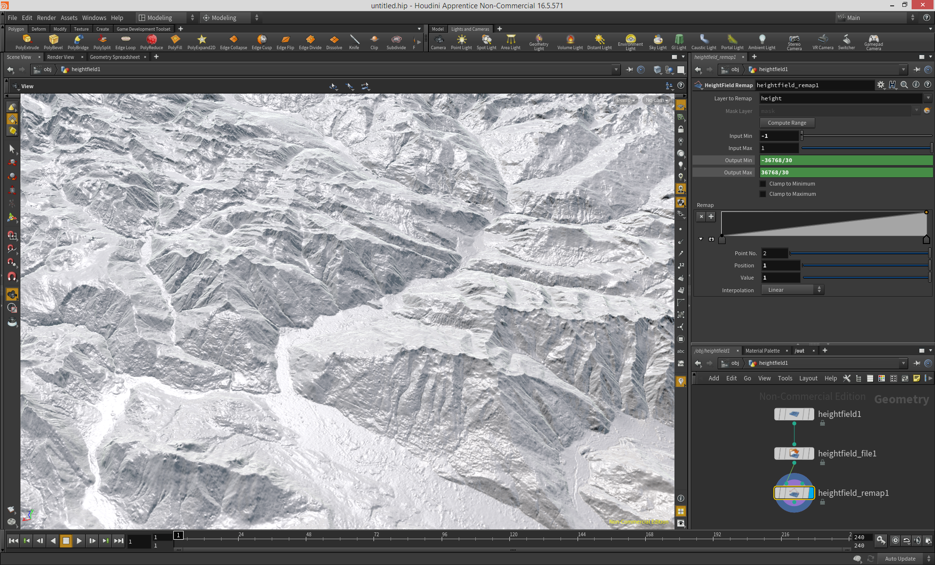
- Create a HeightField object (go inside)
Change the Division mode to By Axis, this way you can control the resolution better.
Grid Samples: 3600
Size: 3600 and 3600 - Add a HeightFiled File node. Select the downloaded tif file.
Change the Layer Name to height (to get elevations not a mask).
Size, Size: 3600 - Add a HeightField Remap node. Because how the data stored you have to remap the height values this way (you’ll get correct elevations but you have to divide it by 30 because earlier we did’t scaled up the size of the terrain in XZ):
Input Min: -1
Input Max: 1
Output Min: -32768/30
Output Max: 32768/30
That's it. :)
- If you want a smaller peace of the terrain you just have to change the Size parameters at the HeightField node (for example 1000 by 1000) and change the center X and Z. You may want to lower the resolution accordingly.
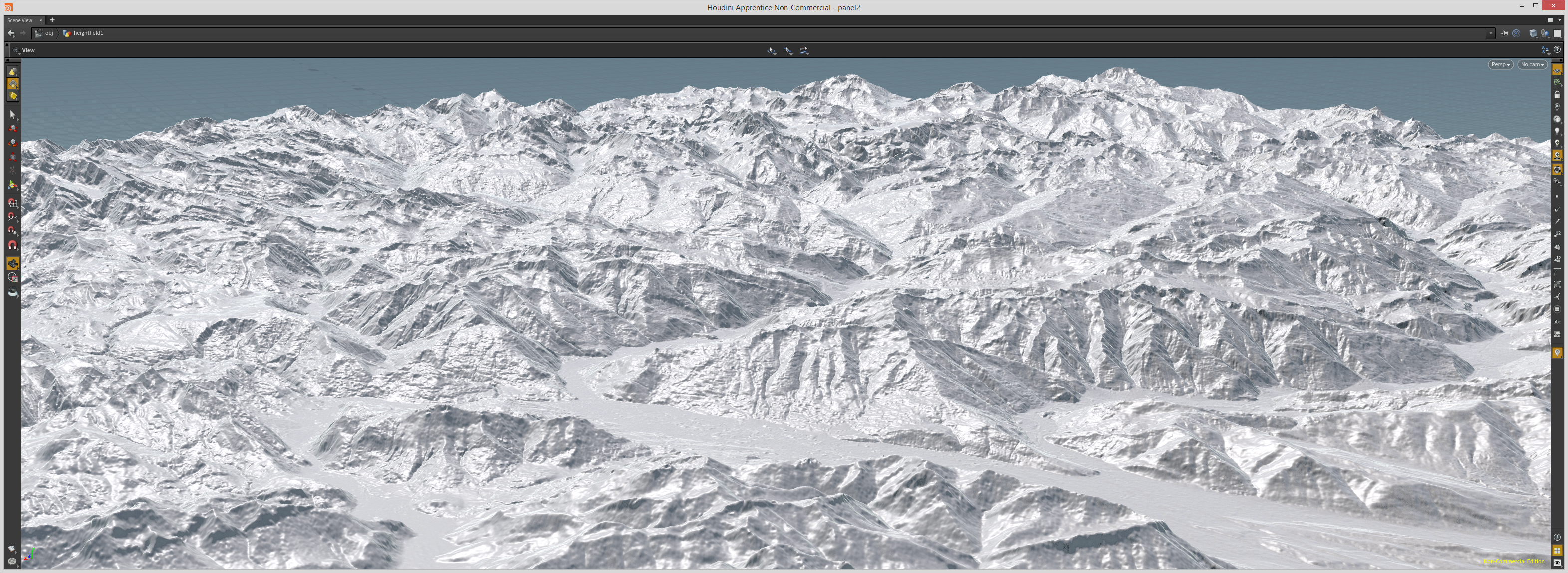
- After the you created a base you can modify it with the usual Height Filed nodes.
- You can upscale the whole terrain to get 1:1 sizes with the HeightField Transform node (Uniform Scale: 30).
- You may have to correct a few data error with an image editor software (simple way). Errors are usually at the non interesting part of the image outside the acual terrain (oceans).
Cheers, D

COMMENTS
Seaton 5 years, 6 months ago |
Some GeoTiff images have some white noise pixel, some very high posts presented after importing.
ddankhazi 5 years, 6 months ago |
Yes, that is possible. The original data is not perfect. Every elevaton data download site using the same source.
A simple way to correct this is with an image editing software.
Cheers, D
revilo3d 5 years, 6 months ago |
You can also correct this in sops with VEX. Check out this video to see an example of how that is done.
http://www.entagma.com/houdini-game-tools-assembling-a-3d-scan-of-the-earth/
losseven666 5 years, 5 months ago |
I can't download the map. Would you tell me what's the problem with my browser? When I log in and found a map what I need , I press the download button,but the page loading failed .. My english not well,help me please :)
ddankhazi 5 years, 4 months ago |
Sorry to hear that. I just checked it.
It's working for me.
baaz 5 years, 5 months ago |
Thanks a lot for this tutorial !
Pardon my noobness, but where does the values 36768 and -36768 come from ? I don't get that part.
Best Regards,
Basile
ddankhazi 5 years, 4 months ago |
It's how the data stored in the actual geoTiff files.
It's a 16 bit/channel image file and every value step is one meter (65.536 value differences means meter in total).
This geoTiff files contains negative and positive values as well.
In this case the 0 meter elevation is the value 0. The lowest elevation is -36768 meter and the highest is 36768 meter.
Cheers, D
FloreV 5 years, 3 months ago |
Sorry if I'm necroposting, but if we have 65 536 values in a 16bit image. Don't we just have the half the number to get our positive and negative range? In this case 32 768? Or more specific -32 768 - 32 767. I don't get were your numbers( 36 768) are coming from. Sorry I'm bad with math and numbers.
And what about a 32bit image?
Not sure if it's usefull to use all 4,294,967,295 values
Thanks for the article either way, it's usefull!
ddankhazi 5 years, 2 months ago |
Hehe…
Yep, that was a typo.
Of course the 32768 is the correct number.
Cheers
baaz 5 years ago |
Hello,
Just seeing your reply now, thank you for your answer !
ddankhazi 3 years, 6 months ago |
There is a simple way to remove the incorrect data (too bright pixels) in Houdini:
– Select the heightfield_file node
– RMB -> Allow Editing of Contents
– Open it
– Go inside the cop2net node at the top and open it
Put a limit node between the File node and the switch node
Set the lower limit to: -0.5 (so you will keep the data under the see level)
Set the upper limit to: 0.5 (so you clamp the data at half of the maximum possible value, it’s more than enough)
Clamped Values: Replace with Black (usually the too bright values were originally at the see level)
That’s it.
Nathan Apffel 3 years, 3 months ago |
Thank you for this tutorial. I am finding it very useful. I'm thinking about creating a topo map of a relatively small area of maybe only a few acres. I wonder if anyone know of a source of data like this that is even higher resolution? That I could get detail zoomed way in. I know it seems like a lot to ask.
lehmann_steffen 3 months ago |
Hi, thank you for the info. I am trying to use https://earthexplorer.usgs.gov to get some areas of the mojave desert. It is a nightmare. Do you have any information on how to get a DSM file on this site? Or can you recommend another site for US areas? Thank you
Please log in to leave a comment.